
LAWIS plus (Switzerland)
This guide shows you how to export your parcel and area data from the new LAWIS plus system and send it to Vinitor. Since 2025/2026, LAWIS plus has been gradually replacing the previous Agricola system (agriPortal).
Export from LAWIS plus
Section titled “Export from LAWIS plus”-
Log in to agate.ch
Open www.agate.ch and log in with your Agate username and password.
-
Open LAWIS plus
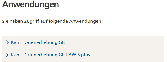
Under “Anwendungen” (applications), you’ll see two links for the cantonal data collection. Click “Kant. Datenerhebung [your canton] LAWIS plus” (cantonal data collection [your canton] LAWIS plus) — for example “Kant. Datenerhebung GR LAWIS plus” for Graubünden. The older link without “LAWIS plus” leads to the previous agriPortal.
-
Select your business and start the data collection
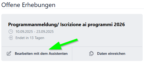
You’ll be redirected to the data collection selection. Click the open collection (e.g. “Programmanmeldung 2026”, programme registration 2026) and select “Bearbeiten mit dem Assistenten” (edit with the wizard) to start the data collection.
-
Overview of the sections
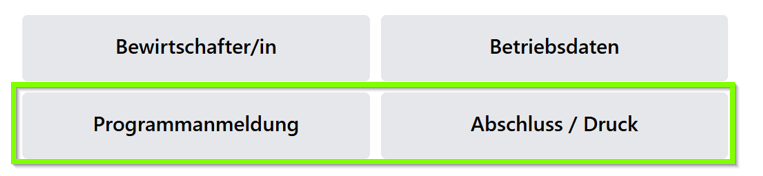
On the start screen you’ll see four tiles: “Bewirtschafter/in” (operator), “Betriebsdaten” (business data), “Programmanmeldung” (programme registration) and “Abschluss / Druck” (completion / print). Navigate through the sections until completion, or go directly to the “Dokumente” (documents) section in the left-hand menu.
-
Complete the data collection
Confirm that your details are correct and complete, then click the green “Datenerhebung abschliessen” (complete data collection) button. After completion, your data is compiled into a document and filed under “Dokumente”.

-
Export geometry data
In the “Dokumente” section you’ll see three buttons: “Datei hochladen” (upload file), “Geometriedaten exportieren” (export geometry data) and “Aktualisieren” (refresh). Click “Geometriedaten exportieren” (export geometry data). The system generates a file containing all the area geometries for your business.

-
Save the exported file
The exported file is offered for download. Save the file to your computer.
-
Import the files into Vinitor
Open the Vinitor Dashboard and navigate to the Field record book. Click Import in the top right and select LAWIS+ (Switzerland) as the import source.
For LAWIS+, Vinitor needs two data files, which are uploaded into separate upload fields:
Data file Contents KUL file (crops) Contains the area geometries of the vineyards BWE file (management units) Contains the names/designations of the vineyards Upload both ZIP files into the respective fields. If a single ZIP archive already contains both shapefiles, upload the crops file as the KUL file and the business-overview file as the BWE file. The import can only be started once both files are present — as long as the BWE file is missing, the Import button remains disabled.
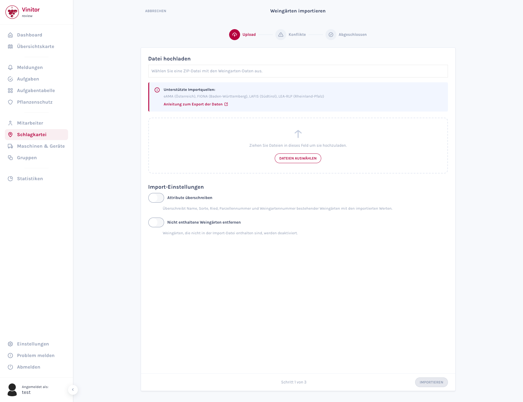
Then click “Import”. The wizard guides you through the import in three steps. For detailed information about the import wizard, see Import vineyards.
Frequently asked questions
Section titled “Frequently asked questions”What is the difference between Agricola and LAWIS plus? Agricola (agriPortal/agriGIS) was the previous system for structural data collection. LAWIS plus is the new inter-cantonal system that has been gradually replacing Agricola since 2025/2026. Both systems are accessible via agate.ch.
Where do I find my Agate login details? You’ll receive your login details from your cantonal office of agriculture. For Graubünden: Amt für Landwirtschaft und Geoinformation (ALG), Chur — [email protected], +41 81 257 24 32.
My area data is missing in LAWIS plus — what should I do? Since the transition happens gradually, not all data may have been transferred yet. In this case, please contact your cantonal office of agriculture.
In which format is the geometry data exported? LAWIS plus typically exports the geometry data as a shapefile (.shp) or GeoPackage. Vinitor supports both formats.
SUPPORT
Need help?
Our team is happy to help with any questions about Vinitor.