
eAMA / INVEKOS-GIS (Austria)
This guide shows you how to export your area data (shape files) from INVEKOS-GIS via the eAMA portal of Agrarmarkt Austria, and import it into Vinitor.
Export from INVEKOS-GIS
Section titled “Export from INVEKOS-GIS”-
Open the eAMA portal
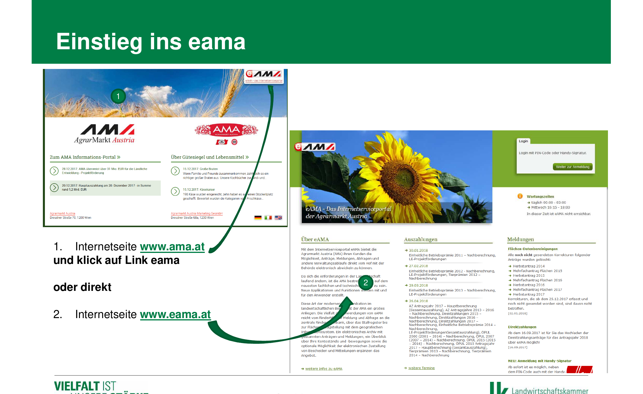
Visit www.eama.at (or go via www.ama.at and click the “eAMA” link). You’ll reach the login page of the eAMA online service portal of Agrarmarkt Austria.
-
Log in
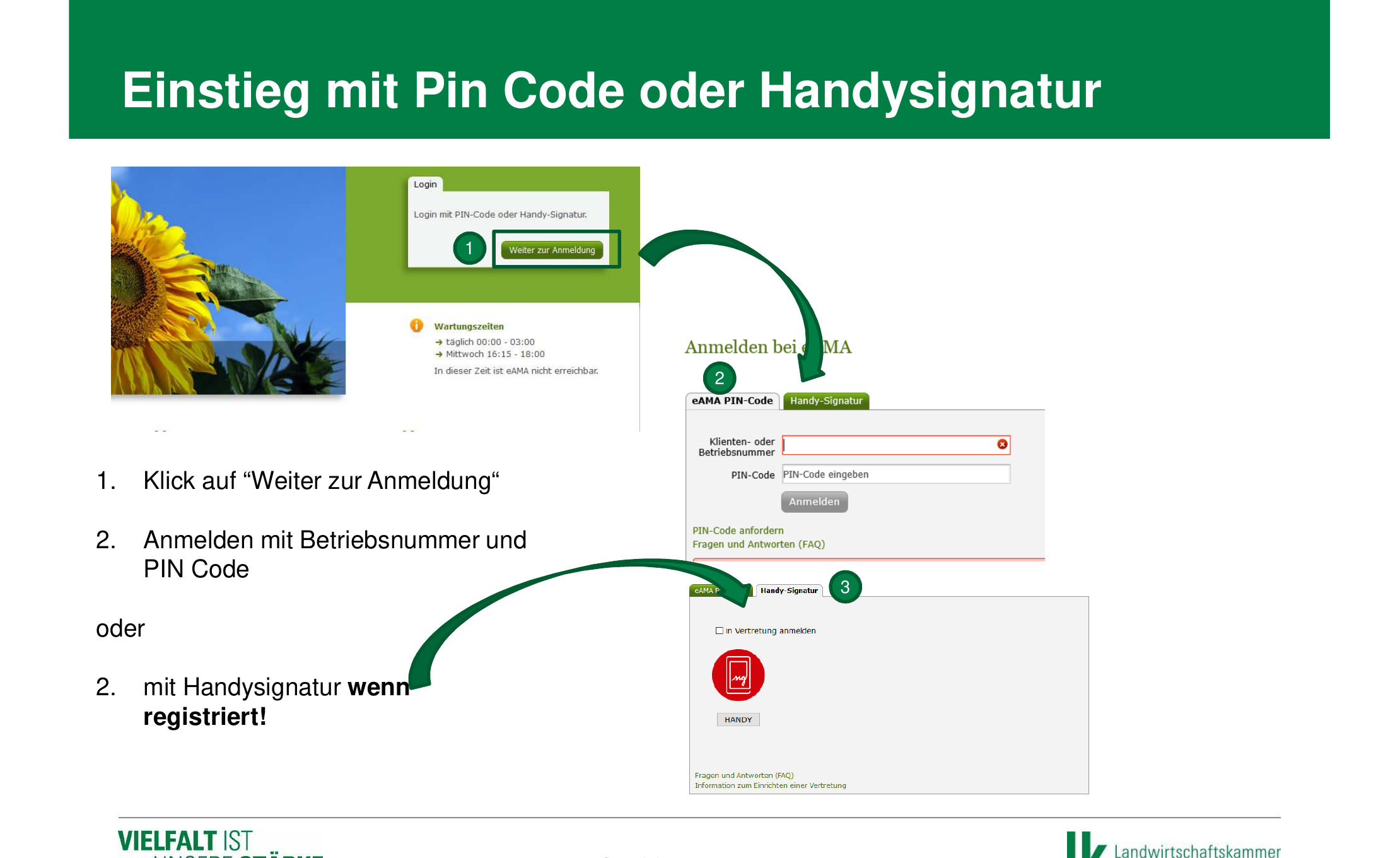
Click “Weiter zur Anmeldung” (continue to login) and sign in with your client or business number and your PIN code. Alternatively, you can sign in via the “Handy-Signatur” (mobile signature) tab, if registered.
-
Navigate to INVEKOS-GIS
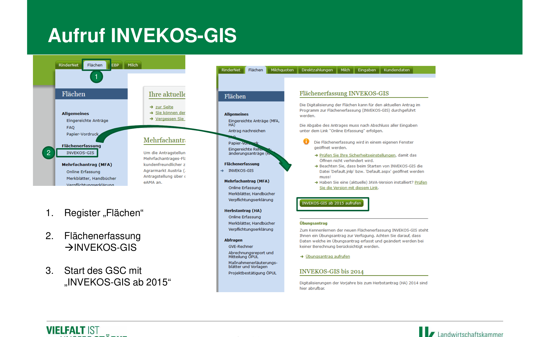
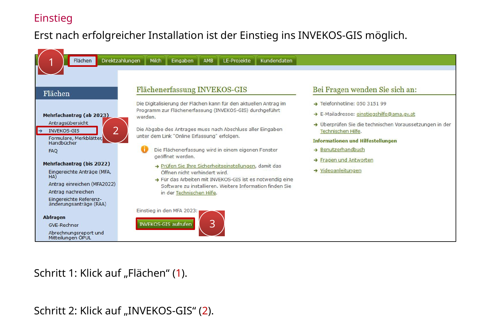
In the top menu, click the “Flächen” (areas) tab. Then, in the left-hand navigation under “Flächenerfassung” (area recording), select “INVEKOS-GIS”. Then click “INVEKOS-GIS aufrufen” (open INVEKOS-GIS) to launch the GIS program.
-
Start the GIS app (first-time setup)
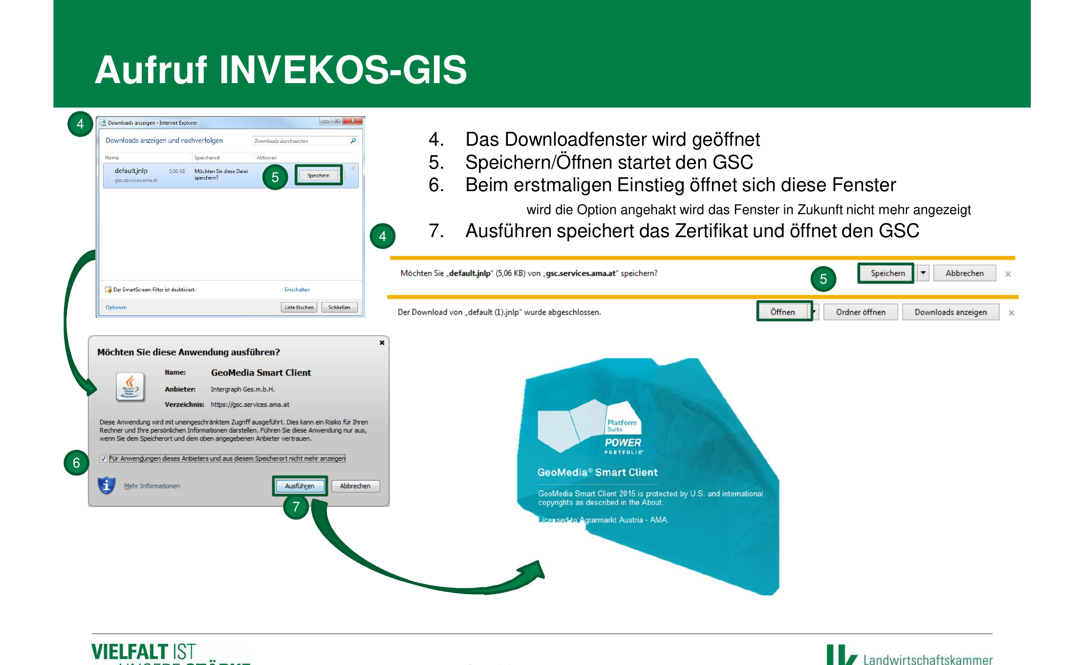
The first time you launch it, a file called “default.jnlp” is downloaded. Save and open this file. A security dialog from the GeoMedia Smart Client appears — tick “Für Anwendungen dieses Anbieters nicht mehr anzeigen” (don’t show this again for applications from this provider) and click “Ausführen” (run). INVEKOS-GIS then starts.
-
Open GIS Datenexport
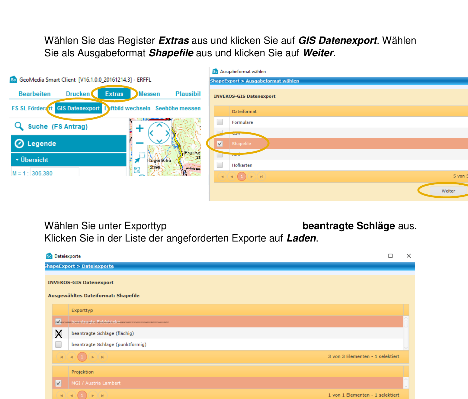
In INVEKOS-GIS, select the “Extras” (tools) tab in the top menu bar and click “GIS Datenexport” (GIS data export). The window for selecting the output format opens.
-
Select shapefile as export format
In the “Ausgabeformat wählen” (select output format) dialog window, several formats are available (forms, CSV, XML, Shapefile, farm maps). Select “Shapefile” and click “Weiter” (next).
-
Select and request export type
Select “beantragte Schläge (flächig)” (applied-for plots, area-based) as the export type. Make sure “MGI / Austria Lambert” is selected under projection. Click “Anfordern” (request). The export appears in the list of requested exports.
-
Download and save the export file
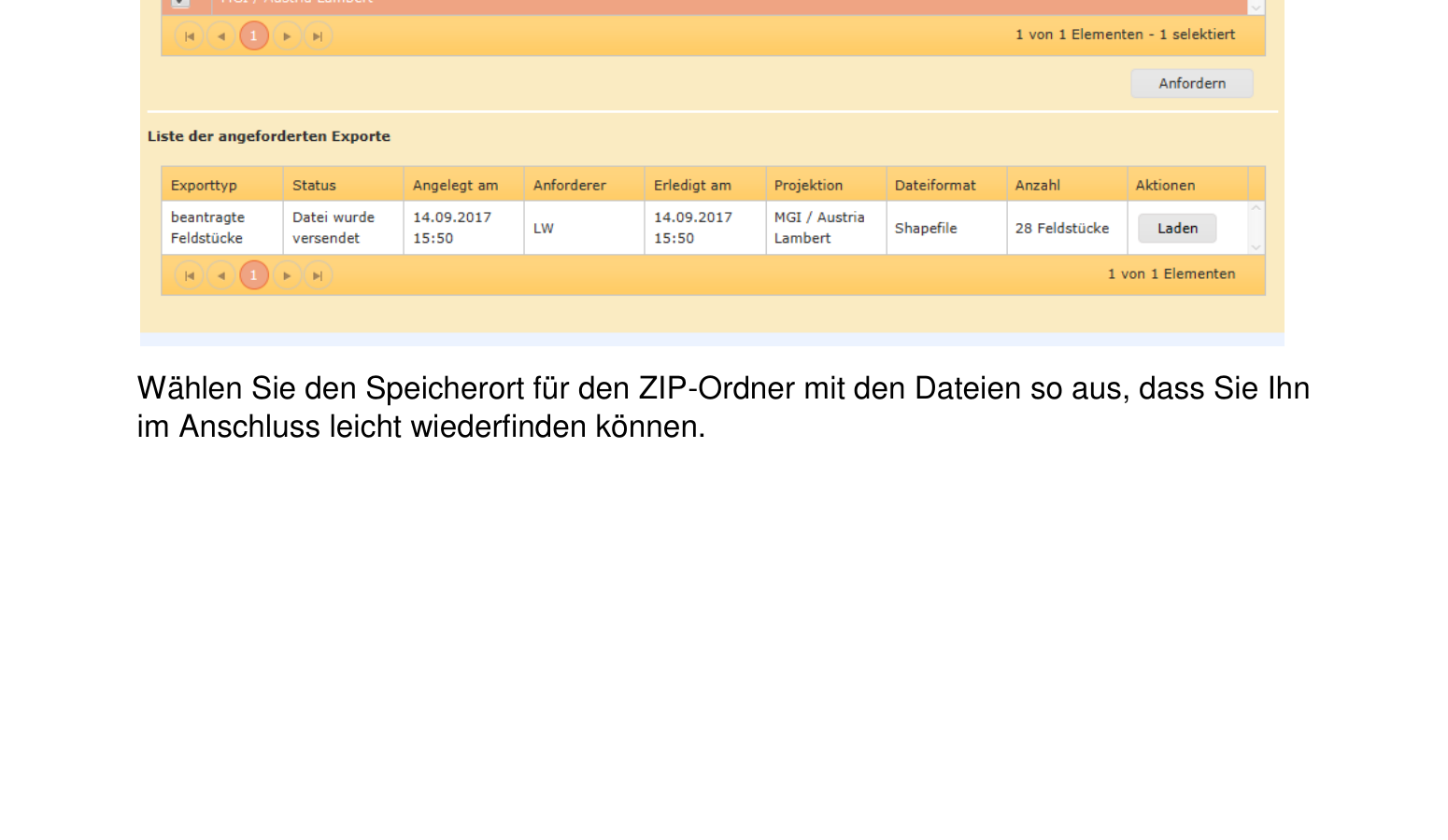
Once the export is ready, click “Laden” (download) in the list of requested exports. Choose a location you can easily find again, and click “Speichern” (save). The file downloads as a ZIP archive.
The ZIP file contains the following shapefile components:
*.shp— Geometry data of the plots*.shx— Spatial index*.dbf— Attribute data with plot number, land use, area, etc.*.prj— Coordinate system (MGI / Austria Lambert)
-
Import the ZIP file into Vinitor
Open the Vinitor Dashboard and navigate to the Field record book. Click Import in the top right, select eAMA (Austria) as the import source, upload the ZIP file and click “Import”.
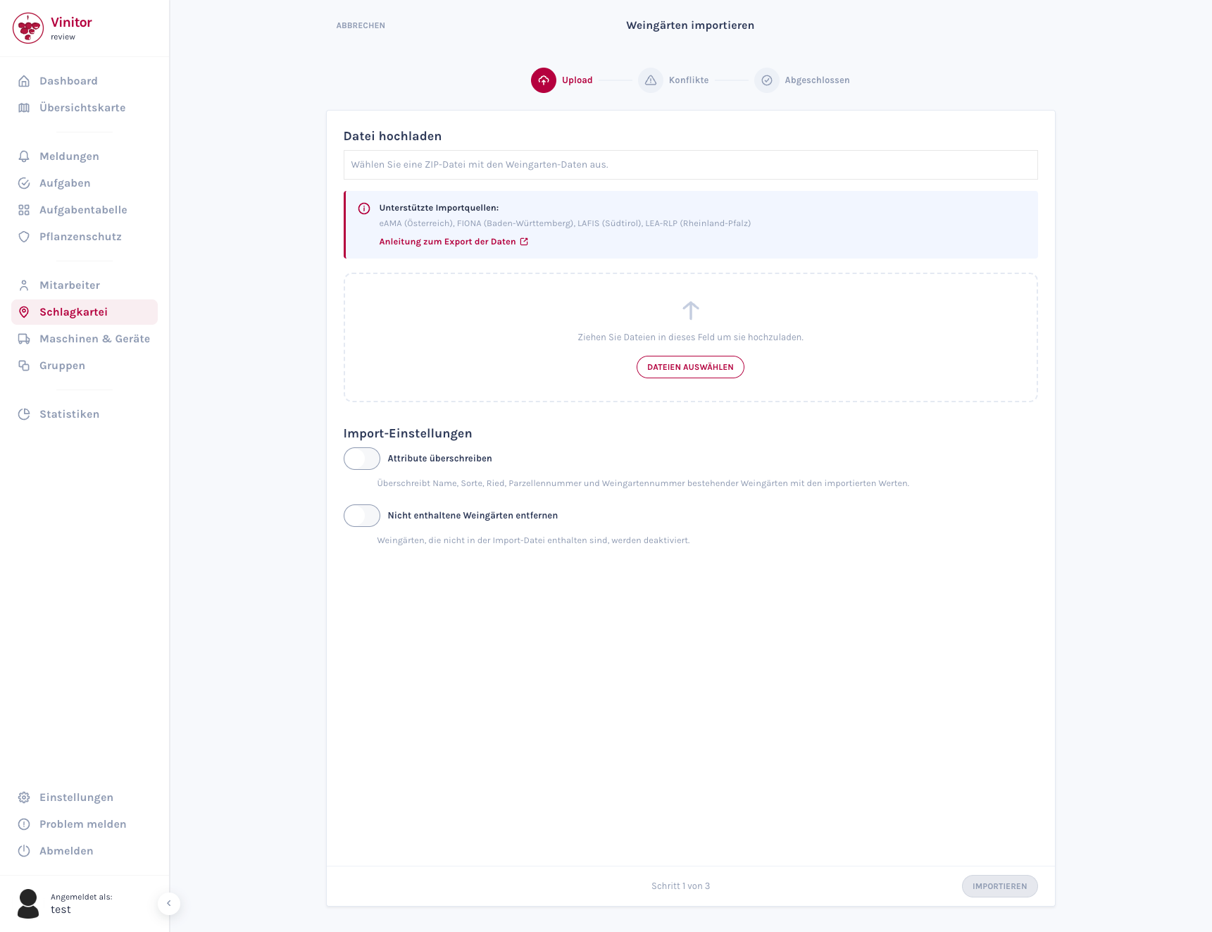
The wizard guides you through the import in three steps. For detailed information about the import wizard, see Import vineyards.
Frequently asked questions
Section titled “Frequently asked questions”I can’t log in to eAMA — what should I do? Check your business number and your PIN code. If you’ve forgotten your PIN, you can request a new PIN code via the eAMA login page. Alternatively, sign in with ID Austria (Handysignatur).
The GIS app won’t start — what can I do? INVEKOS-GIS requires a 64-bit Windows operating system and the GIS app (Hexagon App Launcher). Check the system requirements under “Technische Hilfe” (technical help) in the eAMA portal, and download the current version of the GIS app.
Which export type should I choose — plots or field blocks? For Vinitor, we recommend exporting “beantragte Schläge (flächig)”, as this includes the individual vineyard parcels with their detailed land-use data.
Can I also export the data as CSV or XML? Yes, INVEKOS-GIS also offers CSV and XML exports. However, the Shapefile format is required for import into Vinitor, as it contains the geometry data (area outlines).
I use a Mac — can I use INVEKOS-GIS? Unfortunately, INVEKOS-GIS is only available for Windows. On a Mac, you can alternatively use Windows virtualisation (e.g. Parallels, UTM). Contact us at [email protected] — we’re happy to help you with the data import.
SUPPORT
Need help?
Our team is happy to help with any questions about Vinitor.