
Vineyards — Overview
The field record book is the heart of Vinitor. Here you capture and maintain all information about your vineyards — from master data such as grape variety and area to map geometries, tasks and documents.
List view
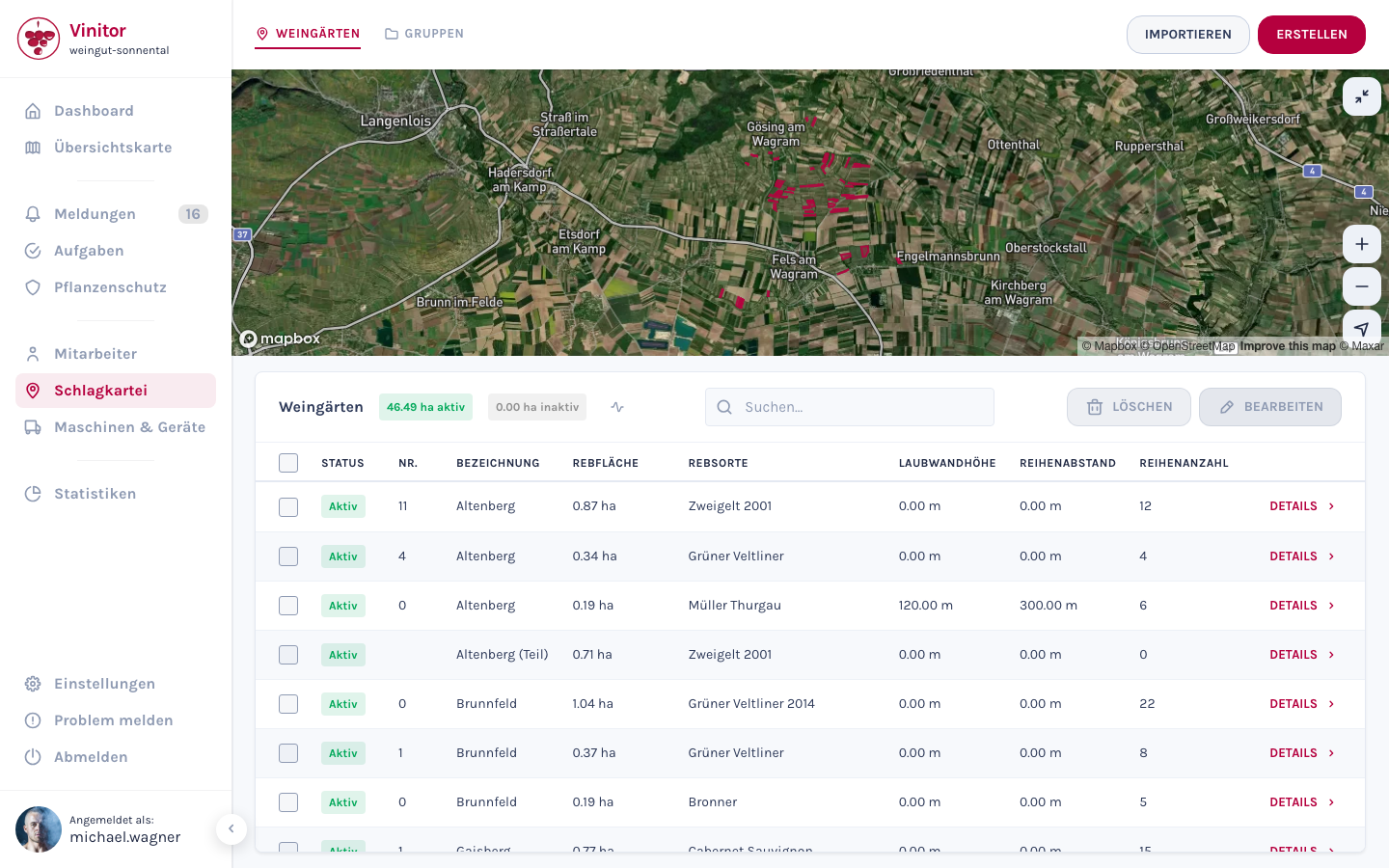
Section titled “List view”The field record book shows your vineyards in a table with an integrated map view. The map at the top shows the drawn areas of your vineyards — click an area to highlight the corresponding entry in the table.
In the table you can see at a glance:
| Column | Description |
|---|---|
| Status | Active (green) or Inactive (grey) — inactive vineyards are excluded from billing, task assignment and reports |
| No. | Internal business number for unique identification |
| Name | Name of the vineyard |
| Vine area | Area in hectares (ha) |
| Grape variety | Variety grown (e.g. Grüner Veltliner, Zweigelt) |
| Leaf wall height | Height of the canopy in centimetres — relevant for plant protection calculations |
| Row spacing | Distance between the vine rows in centimetres — also for plant protection calculations |
| Number of rows | Number of vine rows in the vineyard |
All columns are sortable (ascending/descending). Use the search field to filter by name, number, grape variety and other fields.
Features
Section titled “Features”Create and import vineyards
Section titled “Create and import vineyards”You can create new vineyards either individually — via a guided wizard with map drawing — or in bulk via import from external systems (e.g. eAMA, FIONA, LAFIS).
Detail view and editing
Section titled “Detail view and editing”Click a vineyard to open the detail view. There you’ll find all master data, the map view with the polygon, and tabs for tasks, plant protection, groups, files and the change log.
Groups
Section titled “Groups”Use vineyard groups to organise your vineyards by any criteria — e.g. by site, grape variety or management type. Groups can also be used for route planning and creating spray plans.
Files and attachments
Section titled “Files and attachments”You can attach files and documents to every vineyard — from photos and PDF documents to spreadsheets.
Bulk editing
Section titled “Bulk editing”Use the checkboxes in the table to select multiple vineyards at once and edit or delete them together. In bulk editing, you can set a field to the same value for all selected vineyards — e.g. adjust the row spacing for an entire site.
Vineyard attributes
Section titled “Vineyard attributes”Every vineyard has the following master data, which you maintain when creating it or in the detail view:
| Attribute | Description | Important for |
|---|---|---|
| Name | Name of the vineyard (e.g. “Altenberg”) | Identification |
| Number | Internal business number | Unique assignment |
| Parcel number | Cadastral parcel number | Official documentation |
| Grape variety | Variety grown (e.g. Grüner Veltliner) | Variety management |
| Rieds | Site name / local name | Regional assignment |
| Vine area (ha) | Area in hectares — calculated manually or from the map geometry | Area calculation, statistics |
| Leaf wall height (cm) | Height of the canopy | Plant protection application rates |
| Row spacing (cm) | Distance between the vine rows | Plant protection application rates |
| Number of rows | Number of vine rows | Work planning |
| Owner | Owner of the vineyard (automatically filled with your business name) | Documentation |
| Notes | Free-text field for additional information | Your own notes |
| Status | Active or Inactive | Billing, task availability |
Mobile app
Section titled “Mobile app”In the mobile app, your employees have access to the following vineyard features:
- Search vineyards — Searchable list of all active vineyards with filtering by name, number and grape variety.
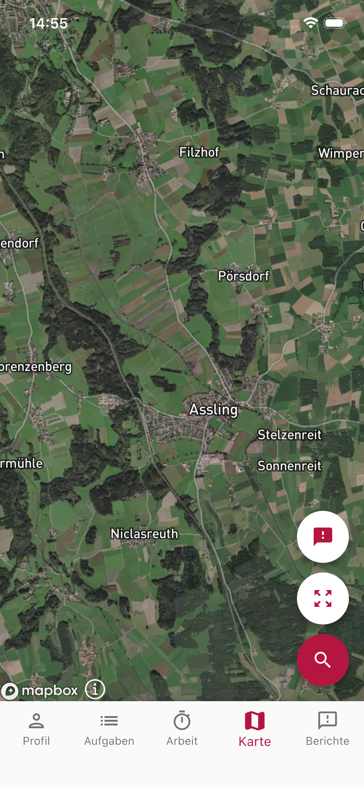
- Map view — All vineyards with their drawn areas on an interactive map.
- Navigate to vineyard — Start turn-by-turn navigation to the vineyard directly from the detail view by tapping the navigation button (opens Apple Maps or Google Maps).
- Detail view — View all master data and access the associated tasks (open and done) directly at the vineyard.
- Offline access — Vineyard data is stored locally and available even without an internet connection.
SUPPORT
Need help?
Our team is happy to help with any questions about Vinitor.